
Page 84 - University of Pretoria RESEARCH REVIEW 2016
P. 84
SOIL EROSION
A CRITICAL ENVIRONMENTAL ISSUE
Soil erosion and the associated land degradation are critical environmental issues that hinder agricultural development and long-term ecological and agricultural sustainability.
Modelling erosion potential at a catchment or on a larger scale helps in predicting erosion hazard, particularly under changing climate and land-use scenarios.
Professor Paul Sumner in the Department of Geography, Geoinformatics and Meterology is part of a team of researchers and postgraduate students who are investigating soil erosion phenomena in South Africa, southern Africa and on the island of Mauritius. He works closely with colleagues at other universities in South Africa and in the Agricultural Research Council, and at the University of Mauritius and the Mauritius Wildlife Foundation.
On Mauritius, erosion assessment has centred
on modelling erosion rates on the island. Model accuracy is dependent on complete assessments of land use, soil characteristics and rainfall erosivity. While team members at the University of Mauritius have focused on erosion risk assessments, South African researchers and postgraduate students have detailed the rainfall erosivity characteristics. These
projects have developed detailed rainfall attributes for more accurate erosion modelling. In a separate study, together with the University of Mauritius and the Mauritian Wildlife Foundation, gully phenomena on an offshore islet, Round Island, have been mapped at a site where severe erosion provides
a challenge in ecological restoration of a nature reserve. Such assessments help in understanding erosion processes and facilitate the rehabilitation of degraded areas.
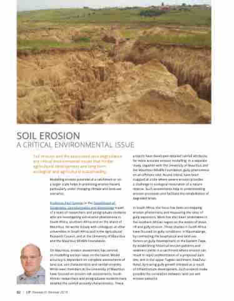
In South Africa, the focus has been on mapping erosion phenomena and measuring the rates of gully expansion. Work has also been undertaken in the southern African region on the extent of sheet, rill and gully erosion. Three studies in South Africa have focused on gully conditions: in Mpumalanga, by contrasting the biophysical and land-use
factors on gully development; in the Eastern Cape, by establishing historical erosion patterns and sediment yields in a catchment where erosion can result in rapid sedimentation of a proposed dam site; and in the upper Tugela catchment, KwaZulu- Natal, by tracing gully growth initiated as a result of infrastructure development. Such projects make possible the correlation between land use and erosion patterns.
82 | UP Research Review 2016
